Sheffield, in the north of England, was the steel capital of the world for the majority of the 20th century. It has a new record now… Allotments!
🕰️ A Brief History of the Allotment
The story of Meersbrook Allotments began in the early 1900s. Sheffield City Council divided land east of Meersbrook Park into growing plots. This followed the Allotments Act 1908, which told councils to provide land for food cultivation.
Locals took up tools and made the land bloom. During both world wars, families relied on these plots for vegetables and herbs. The government urged citizens to “Dig for Victory,” and Meersbrook answered the call.
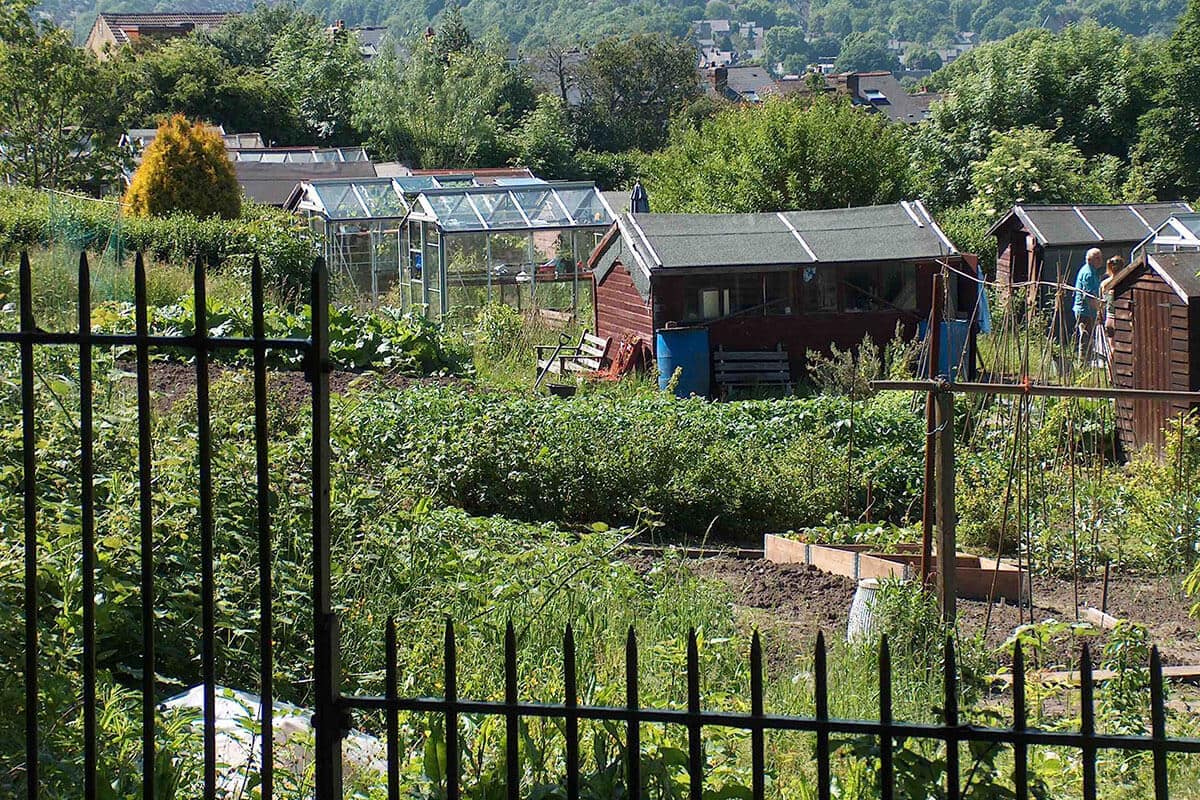
By the mid-20th century, the site had become a vast patchwork of green. With 436 individual plots, it stands as Europe’s largest single allotment site.
In the decades that followed, the allotments grew in purpose as well as size. Locals launched projects like Bloom Sheffield, which transformed unused plots into gardens for therapy, education, and play.
The site remains council-managed, but it’s the people who bring it to life. They grow food, build community, and pass down green knowledge.
Sheffield Corporation buys Meersbrook Park for public use.
Council begins dividing land into allotment plots.
Allotments support wartime self-sufficiency efforts.
Site formalised as Heeley & Meersbrook Allotments.
Projects like Bloom Sheffield add new life and purpose to the site.
🌍 Meersbrook’s True Scale
Tucked into the southern slopes of Sheffield, the Meersbrook Allotments stretch across a vast area directly east of Meersbrook Park in the S8 postcode. With 436 individual plots, the site holds the title of Europe’s largest single allotment site — not in number of sites, but in contiguous, uninterrupted allotment space.
📏 Size and Layout
- Total number of plots: 436
- Estimated overall size: approximately 15–20 hectares (though precise figures vary by source).
- Plot sizes range from around 100 m² to 300 m², typical of British allotments.
- The allotments are arranged in a steep, terraced formation, following the natural incline of the land — a defining feature of Sheffield’s topography.
- Internal lanes, stone paths, and fencing divide the plots in a loose grid, with narrow access tracks for wheelbarrows and gardeners alike.
🗺️ Geographical Features
- Sloping terrain: The site lies on a gradient that drops from Meersbrook Park down toward the Heeley and Meersbrook neighbourhoods.
- The land offers superb views over Sheffield, especially from the upper plots near Meersbrook Hall and the park’s edge.
- A small wooded area, several communal sheds, and occasional ponds or water tanks break up the plot lines.
🧭 Boundaries
- West: Meersbrook Park (17.8 hectares of public green space, including Meersbrook Hall and Bishops’ House).
- North: Residential streets like Meersbrook Park Road and Upper Valley Road.
- East/Southeast: Backing onto terraced housing and Heeley City Farm.
- South: Near Chesterfield Road, marking a subtle change in elevation and soil texture.
Leave a Reply